Your flying, on one map — exactly as you flew it.
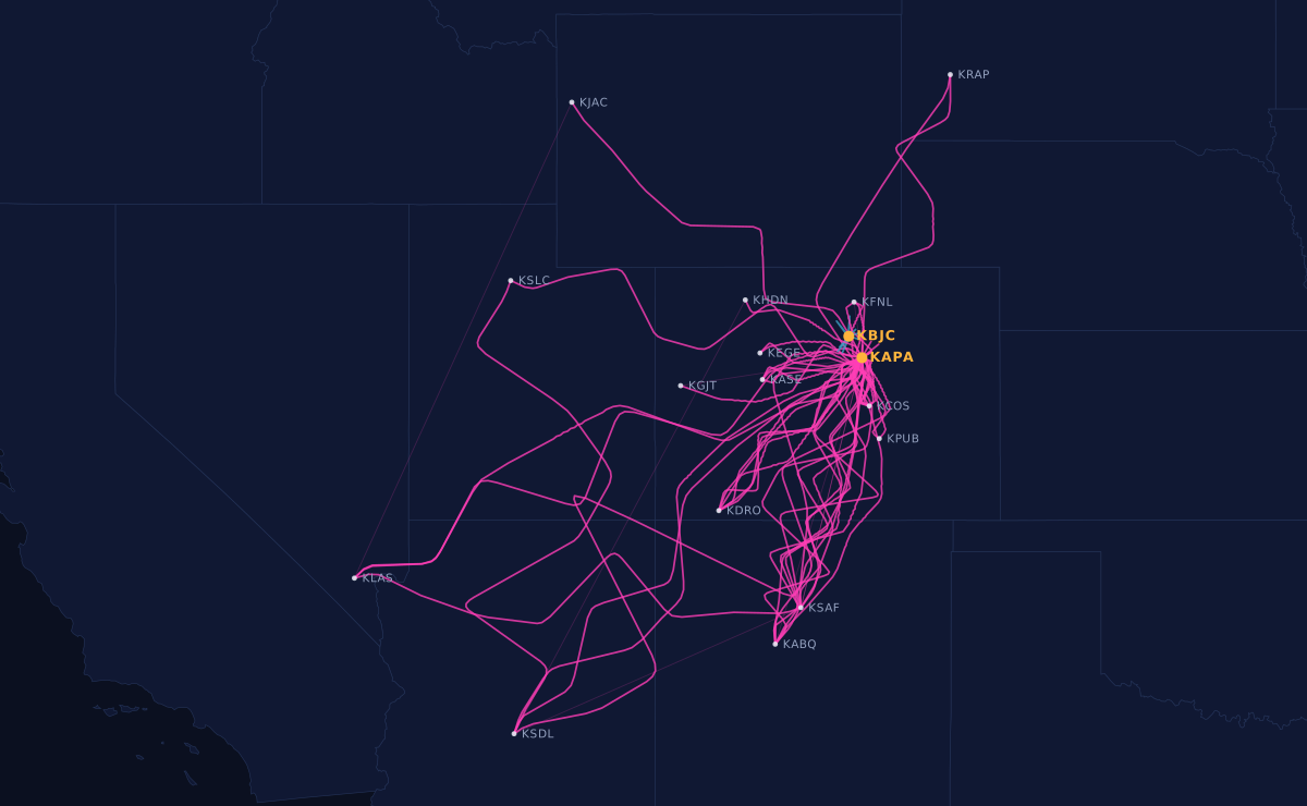
myflites turns your logbook and your track logs into a living map of every flight you've made. Real GPS tracks, not straight lines between airports. All of it, not just this year.
 Play the sample map
Everyone else draws a line between two airports.
That's fine until you look at what it does to real flying. An hour of pattern work departs and lands at the same field, so a straight-line map has nothing to draw and gives you a dot. The route you actually flew — the valley you followed, the deviation around the build-ups, the circuits — isn't in the picture at all.
Airport to airport
One straight line per flight. Local flights collapse to a point, because the departure and the destination are the same field. Distance comes out as zero.
What actually happened
The track as recorded. The same local flight is 133 nm of circuits, because that's what it was. Click any leg and you get the route, the distance actually flown, and the height you got to.
A map that knows the difference between a logbook and a recording.
The route, not the ruler
Track logs come in as GPX, KML, CSV or JSON. Where a flight has no recording, the map falls back to an arc and says so, rather than pretending.
Including the ones you rented
Engine-monitor sources only ever see one airframe, so your club and rental time vanishes. A track log is recorded by the iPad on the glareshield and doesn't care what it's sitting in — so the 120 hours you flew before you bought are on the map too.
From your logbook. Never from a track.
A recording measures the recording. Measured against a real logbook over 93 flights, engine-monitor duration ran 9% short of Hobbs. So the tracks draw the route and the logbook owns the numbers — always.
All of it, animated
Not a year in review. Scrub the timeline from your first lesson to last weekend, or press play and watch it fill in.
Parsed on your machine
Your files are read, matched and measured in your own browser. Only the finished map leaves — a few megabytes of thinned track, not hundreds of megabytes of location history.
A URL, not a screenshot
A real page you can send to the family, put in a signature, or hand to a buyer with the logbooks. Not an image you re-export every January.
Three steps, and nothing to install.
There's no way for any service to reach into your ForeFlight or Garmin account and pull your flying out — no API exists for that, for anyone. So the export happens on your machine, which turns out to be the better place for it anyway.
- Export Your logbook as CSV, and your track logs, from ForeFlight on the web. Take both at the same time so the newest flights have something to attach to.
- Drop them in The page reads them in your browser and works out which logbook flight each track belongs to — including days you flew three legs and logged one. Anything it isn't sure about it shows you instead of guessing.
- Publish Review what it found, then put the map at your own address. Update it whenever you have a new export.
Owner-flown aeroplanes that actually go places.
Cirrus, Bonanza, Mooney, Malibu, Cessna, Piper — anything whose logbook has more cross-country in it than circuits. If you've ever tried to explain to someone what a flying year looks like and ended up describing it, this is the picture.
Your panel is already recording
Perspective writes a flight log to the MFD card every second you're powered up — position, altitude, the lot. Nothing to add, nothing to install. Reading those cards directly is in progress; ForeFlight track logs work today and cover the same flights.
One aeroplane, several pilots
Everyone's flying on one map, or each pilot's own — the map is built from logbooks, so it follows the pilot rather than the airframe.
Provenance you can show
"Always hangared, flown regularly" is an assertion. Two hundred tracks over four years is evidence.
The sample map is the real thing.
Same code, same map, a made-up aeroplane. Scrub the timeline, press play, click a route or an airport. The pattern work at the home field is the bit worth clicking — this sample leaves it drawn, where a map hides local flights by default and just counts them, because a hundred stacked dots over one airport tell you nothing. It's a checkbox in the filter.
N12345 is a fictional aeroplane and the flights are invented. Every airport position is real.
What it isn't.
- Not a logbook. It doesn't replace ForeFlight or LogTen, doesn't compute currency, and won't sign anything. Keep logging where you log.
- Not automatic. Nobody can pull your flying out of ForeFlight or Garmin on your behalf — there's no API for it. You export, it does the rest.
- Not a debrief tool. If you want to argue about your glideslope tracking, that's a different product.
- Not finished. It runs today on one owner's 295 flights and 636 hours. Accounts, custom domains and privacy controls are what's being built next.
Want a map of your own flying?
It isn't open for sign-ups yet. Tell me what you fly and where you keep your logbook, and I'll come back to you when it is.
Coming soon — get in touch Not open yet